Since the creation of satellite imagery, anglers have been using it to find new waters, and to get a better understanding of the ones they’re already familiar with. However, there is more to it than simply looking at an overhead view of the water. You can learn a lot about a fishery from an aerial view, and these five tips will help you get a better understanding of what you’re looking at, and how it can help you find more fish.
Finding Cover
Having a birds-eye view of the water allows you to quickly identify cover, and one of the most overlooked types of cover for fish are trees. Various species of trees appear different from an overhead view, and you can use that view to determine which trees are deciduous, and which are coniferous. onWater’s own Toren Shirk uses this trick all the time to help determine potential summer holding lies.
“(If) it’s getting to the later part of the spring or even early summer, I’m looking for Hemlock stands. I’m looking for trees that hold leaves longer in the year, because I know that’s going to be a thermal refuge.”
Pockets of trees provide shade throughout the summer, creating cooler water temperatures which trout seek out. To find coniferous trees from an aerial view, look for dark, dense green pockets that appear distinct from surrounding vegetation. They tend to grow in pockets close together, and when you find them, you should anticipate that a few fish will call that section of the stream home.
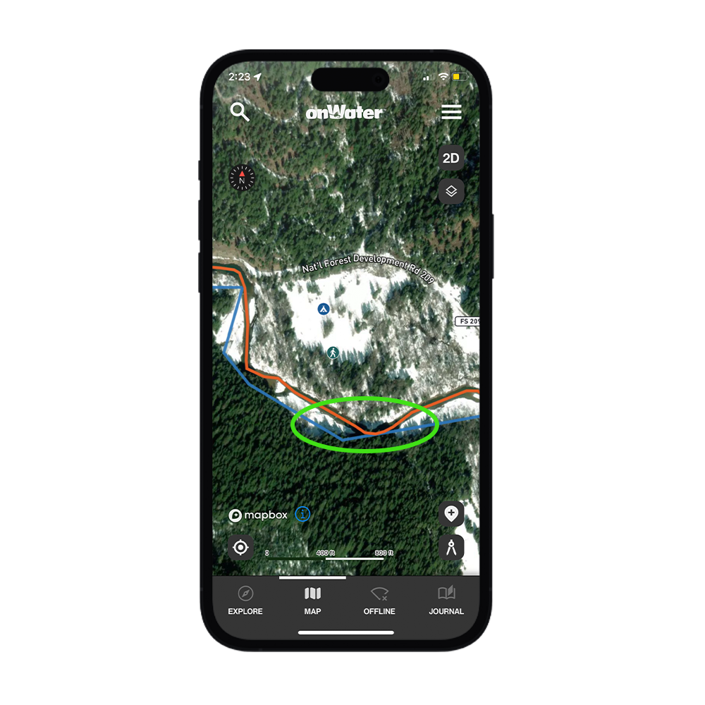
Find shadows and other helpful details with satellite imagery.
Distinguishing Productive Water
One of the great things about satellite imagery is that it makes the water’s features much more obvious to the eyes. River bends, tributaries, and long flats seemingly pop off the map and get your fish senses tingling. Normally you would bump into these areas by happenstance and make note of them, but satellite maps allow you to plan ahead, and with onWater, mark the spots that matter most.
These areas may be tributary entrances, sharp river bends, long slow runs, or pools; anything that jumps out to you as prime fish holding habitat. Once you find these areas, mark them using the My Places feature, and download an offline map so you can have it ready in the field. Once you’re on the water, fish each spot, take notes, and add photos to record as much information about the area as possible. The more you can learn and record, the more prepared you’ll be for your next time out.
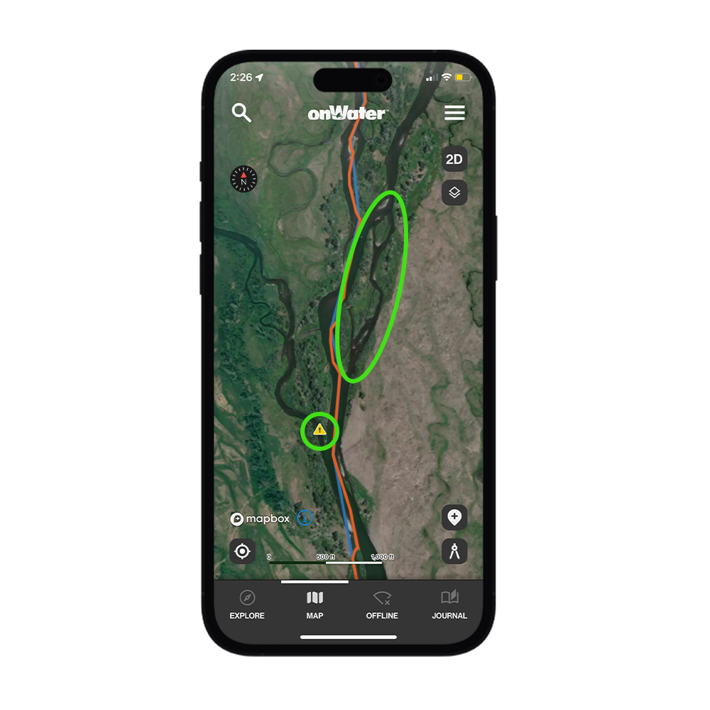
The hazard Point of Interest warns of a diversion dam channel. However, the islands to the right provide habitat that will attract fish.
Distinguishing Hazards
The flip side of using satellite imagery to find fish habitat, is using it to find hazards. A massive threat that most anglers face, especially those fishing from a boat, is whitewater. No matter your experience, or where you fish, whitewater demands respect. onWater maps designate many whitewater rapids, but you can also find them with an overhead view.
Areas where the water appears white and oxygenated from obvious turmoil, and spots with large rock formations and submerged structures, should be treated with caution. Other hazards to avoid are dams, water diversions, and anything else that sticks out as an obvious danger. Keep them in the back of your mind, and mark their locations in the app when you’re on the water. They may turn out to be of little threat, but it’s better to be safe than sorry.
Finding Public Land and Lesser Used Access Points
Beating the crowds and getting on unpressured water is one of the best ways to consistently find fish, but few anglers are willing to put in the work to make this happen. Some may drive a little further to get away from the competition, but perhaps the best way to find solitude on the water is to take the shoelace express.
Once you get to your access point, hiking for just 10 minutes before touching the water will help you find less pressured fish. Which, in turn, will help your catch rate go up, and give you more confidence the next time you visit that water. Another great way to find those remote areas is by accessing directly through public land. You may have to park a distance from the water, and brave a long walk in, but the water you find will largely be untouched. If all goes well, it just might become your new secret spot.
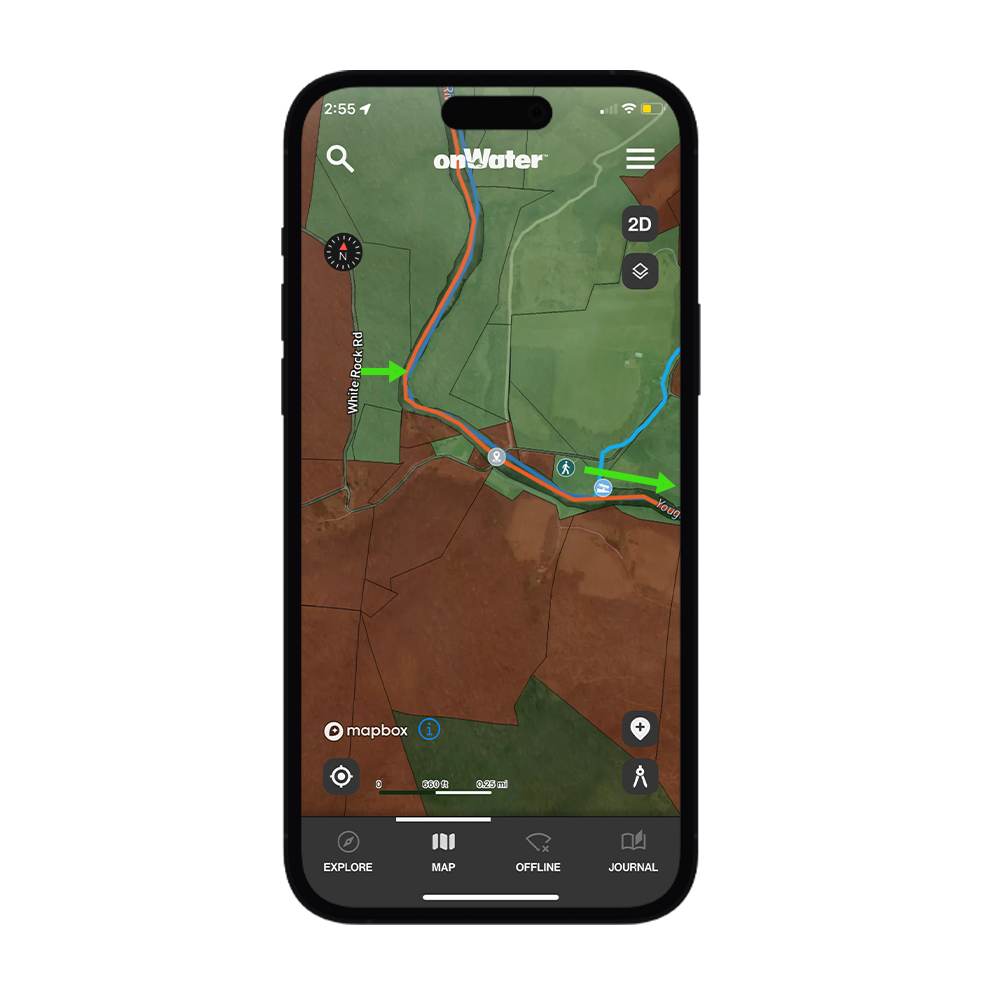
Use the Access Point and hike away from pressure, or enter through public land.
Use it to Make the Most of Your Float
Satellite imagery isn’t just useful to the walk-and-wade angler. Boaters have been using it to plan out routes for years, and they allow you to get a preview of what you might see on the float when you’re planning your next trip.
However, onWater maps help take that preparation to the next level. Along with marking boat ramps and hazards, they help you to quickly find the distances of your floats, and notify you when you’re near your next stop. If you’re planning to take your time on the float, they’ll show public lands where you can legally anchor up and fish, and campgrounds where you can rest before getting the trip back on track.
Satellite imagery has been used for outdoor adventures since it first became available to us, and it’s always been a favorite tool of the angler. The thing is though, they just got a whole lot better at helping you Explore Your Water.
Discover More Ways to Fish Smarter
Be sure to read onWater fishing blog posts to plan better and fish smarter.
3D Fishing Maps for Rivers, Creeks, and Stillwaters