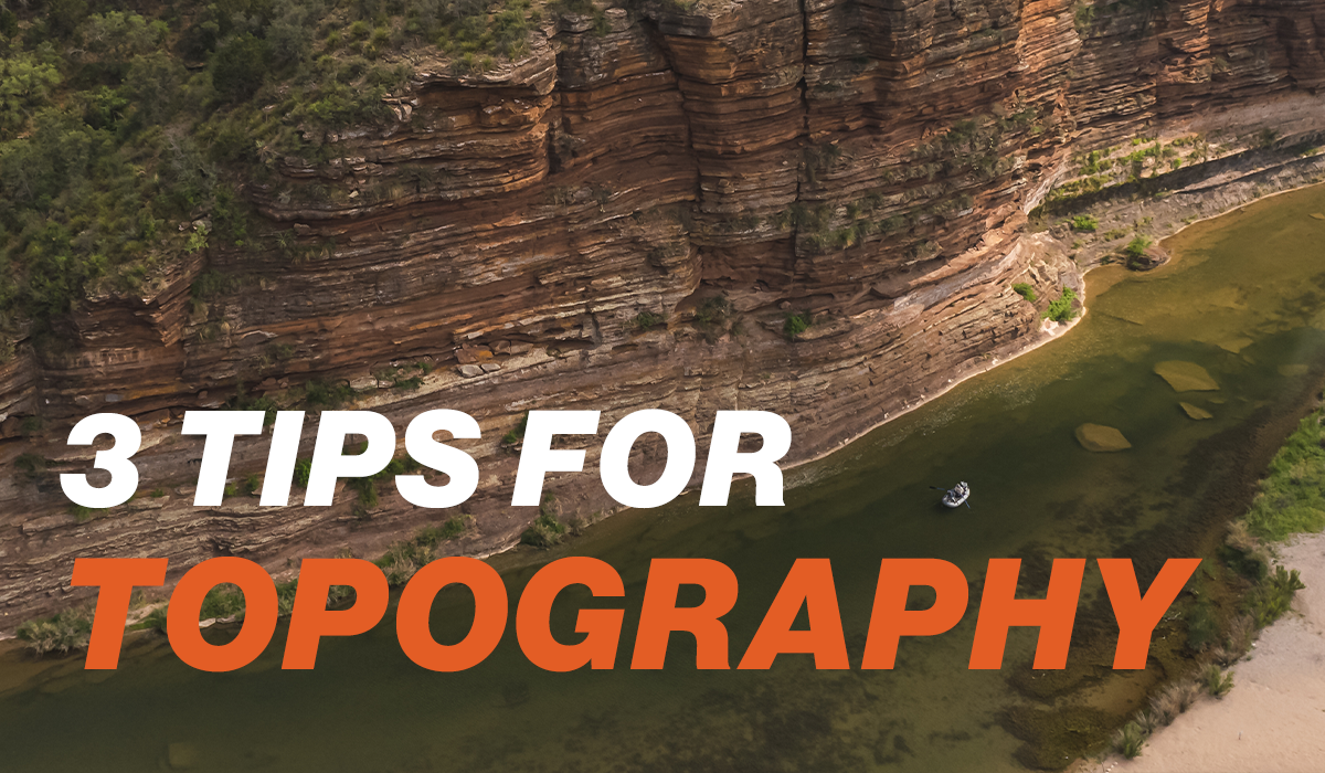
One of the most important aspects of reading a map is knowing how topography works. Once you have a basic understanding, it becomes easy to read, and easy to put in practice. However, topo maps are better for fishing than most people realize. Obviously it shows you how steep the terrain is in the area you want to fish, and it gives you an insight into what you can expect moving around the water. But, it also provides you with details that give you a much better understanding of the water itself, and where fish are likely to be within it.
Here Comes the Sun:
One of the best things about Topo maps is that they give you a huge advantage in knowing where the sunlight will, and won’t, hit the water.
For instance, we know that the sun rises in the east, so we can assume that if there is a mountain on the east side of the stream, that side of the water will mostly be without sunlight till mid-day. This means that the western bank will receive sunlight first in that section, and will be more productive on days when the water’s cold. The fact exists for the evening too, as the western bank is likely to receive less sun in the evening if it is mountainous.
Use topography to find which areas of a waterbody will be in the shade depending on the time of day.
You can also estimate how long the sun will be off the water, based on the height of the terrain on the bank. If there are fields surrounding the stream, obviously the topography will have no effect. However, the sun will touch the water much sooner if it rises over a 1,000 ft mountain compared to a 3,000 ft mountain. So read the topo maps surrounding your local waters, and use them to make a game plan. On cool days, hit the sunny sections first, and on warm days, do the opposite. You’d be surprised at how drastically this little detail can change the way fish behave.
Using Elevation Change to Predict Habitat
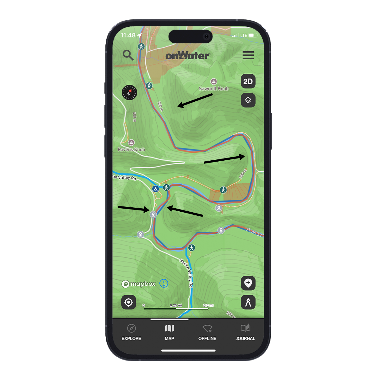
Topography doesn’t just show you the terrain surrounding the water. It can also give you a great understanding of how that water is likely to appear when you get on the river.
If you’re looking at a stretch of river that stays at roughly the same elevation over a long distance, you can usually assume that the water will be flat, with longer, slower runs and riffles. Obviously the structures in the water itself will be the biggest factor on where fish lie, but you can expect shallower, slower water in these areas compared to those with quick changes in elevation.
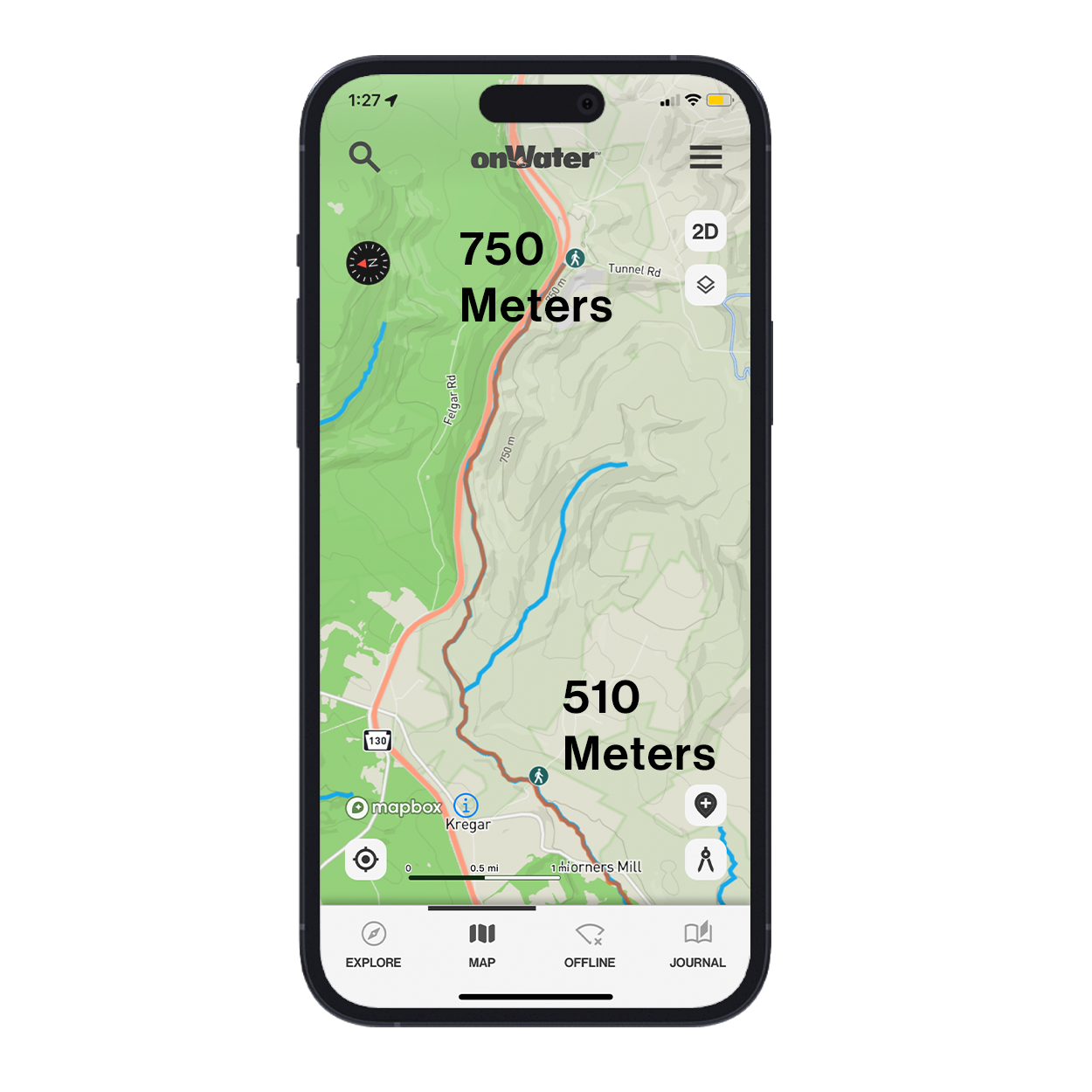
This stream drops over 200 meters in a small distance. Expect this beat to have more turbulent water.
Areas that drop rapidly in elevation, let’s say 100 meters or more in a short length of river, are more likely to have turbulent water. These sections usually have higher levels of oxygen, and are made up of faster, shorter runs and riffles. The faster the land descends, the quicker the water will roll through, creating that turbulence that many fish love. Some anglers call this pocket water, and it’s the type of water where you get short drifts into tight holding spots. Fish with precision and accuracy to make the most of the opportunities you get.
When the Water’s Up, Go Higher
It’s no secret that streams clear out first in their higher reaches, but many anglers still stay home when the water’s high. Can it be more difficult to fish? Yes, but it also can be great, and if you know where to find fishable spots using topo maps, you can find success.
Some of the best places to quickly find fishable water are in the tributaries. Use topography maps to quickly find the little blue lines that feed into the main river, and fish the areas that are close to the mouth. Many fish will use the high water as an opportunity to explore new territory, and you can get onto them by targeting these areas.
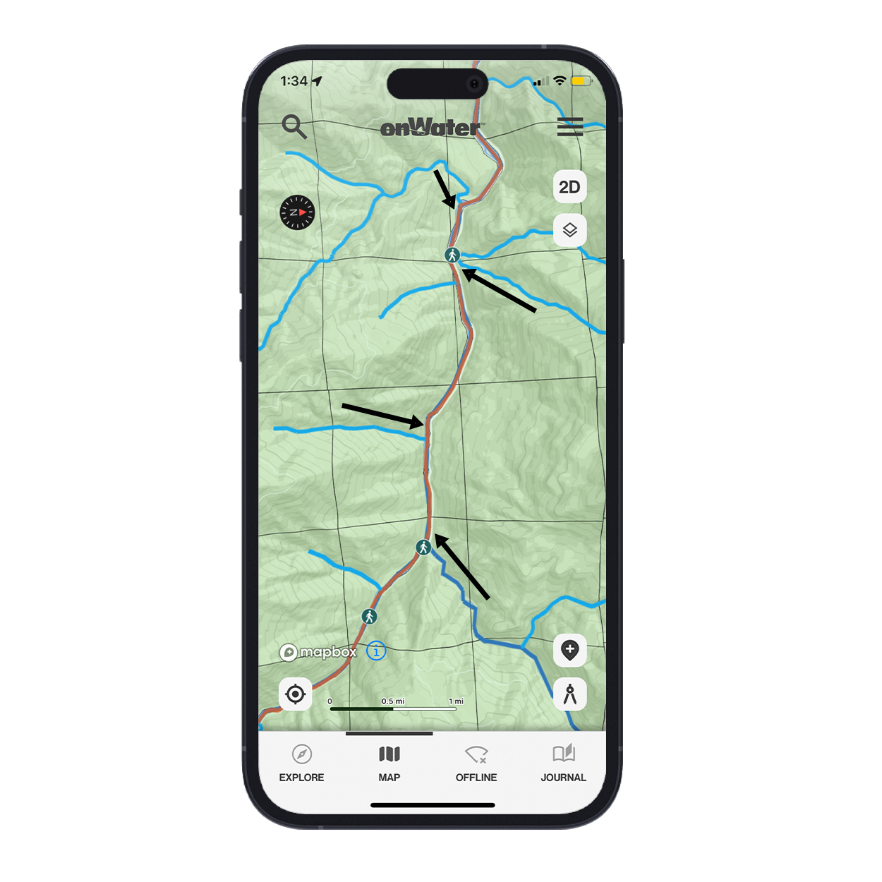
Multiple tributaries enter this river in a short distance. If the main branch is high, either fish the tributary entries, or head above them to higher elevations.
If you’re having trouble finding success, go higher in search of clearer water. Fish love cloudy water, but if they’re having trouble seeing your presentation, you’re going to have trouble hooking up. Look for water that’s stained but still moving at a normal pace. The higher you go, the cleaner and lower the water is likely to be, so skip over the areas where lots of tribs enter the main branch. They’re only bringing more water into that river, and it’s important to get above the entries, and excessive flows.
Topo maps are an invaluable tool for the angler. They provide so much more information than how the land around the water is shaped, and they give you the confidence to fish more tactically, and purposefully your next time out.
Discover More Ways to Fish Smarter
Be sure to read onWater fishing blog posts to plan better and fish smarter.
3D Maps Help You Fish Better. Smarter.