Plan better, fish smarter, and explore more with onWater’s 3D maps. Knowledge is crucial to experiencing great days on the water. Whether you are seeking out new waters, planning to bring someone with you for the first time, or just day-dreaming of your next great fishing trip, onWater’s 3D fishing maps for rivers, lakes, and fly fishing will help you fish rivers near you or find more water to fish.
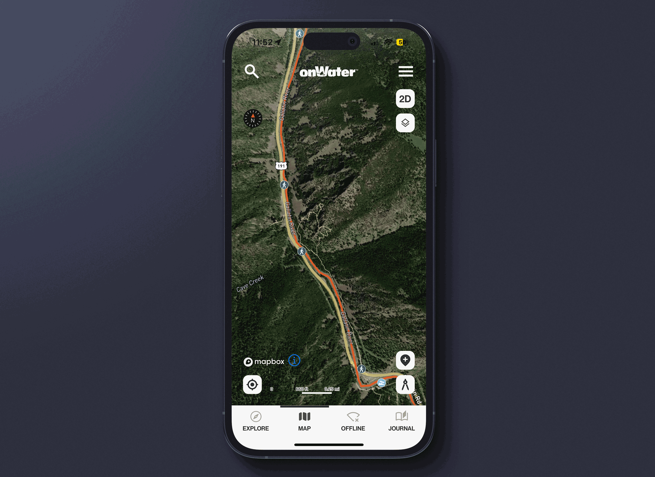
How to Use the 3D Map Layer
1. Open a waterbody map by tapping on View Map + Points of Interest.
2. When the map view opens, look in the upper right corner and tap the 2D/3D icon.
3. The map view will automatically tilt and revert to 3D.
4. Use two fingers to zoom in/out and adjust the tilt; and one finger to move around the map.
5. Use the Layers icon in the upper right to change Map Style view, for example Satellite, Outdoors, and more.
E-Scout New and Favorite Waters With the 3D Map Layer
Using our new technology, finding fishing spots rises to a whole new level. Scout access trails for elevation gain or loss, know just how steep the canyon walls are, or discover runs or banks that could be shade-covered and home to lurking brown trout. With our 3D mapping layer, you can visualize public and private property layers as well as Points of Interests. The 3D map view layer allows you to E-Scout like you’re standing there, rod in your hand, ready to make the next cast, or hike up-and-around to get to untouched waters.
Discover More Ways to Fish Smarter
Be sure to read onWater fishing blog posts to plan better and fish smarter.
Three Ways Topo Maps Help You Find More Fishing Spots