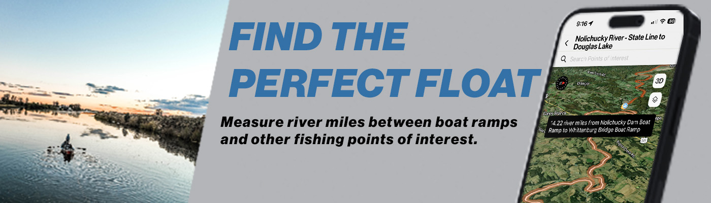
Ever wondered how far it is to the next boat ramp? Looking for a river near home to go fishing? Want to know how far upstream or downstream the “next bend” actually is? With onWater’s Measuring Distances tool, you can know exactly how far it is from one point to the next to find places to fish near you. Measuring Distances with onWater allows you to find places to fish close to you and to fish more confidently.
How to Use the Measuring Distances feature
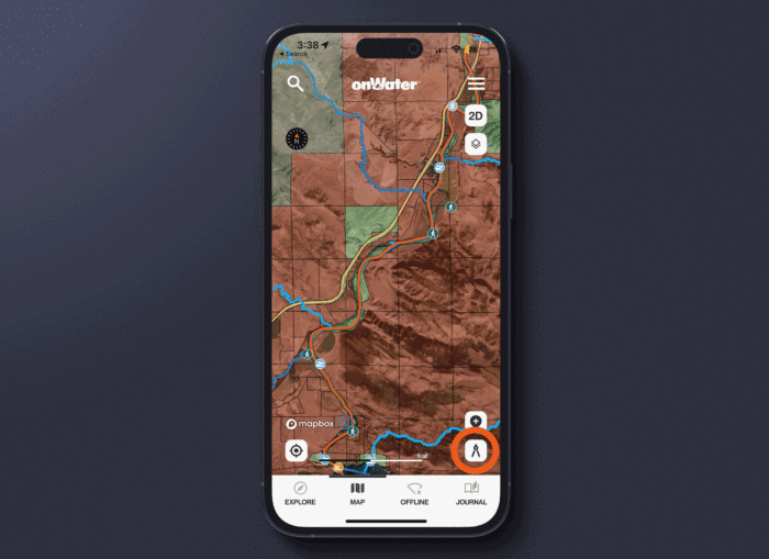
1. Open a waterbody map by tapping on View Map + Points of Interest.
2. When the map view opens, look in the bottom right corner. You may wish to zoom in.
3. Tap the divider icon.
4. The app will ask you to select any Point of Interest, and then another Point of Interest.
5. It will then tell you the exact distance in river miles.
E-Scout and Find Places to Fish Near You by Knowing Exact Distances
Never miss a boat ramp, take-out, or favorite fishing spot again. By knowing the exact distances to, from, or between Points of Interest, your fishing is taken to a whole new level. For trip planning you can know how long a float will be, or how many miles you need to walk to get to the next great fishing spot.
Not only is this tool essential for safety because you can know in real-time how far you are from a hazard or a boat ramp, but being able to measure exact distances means you will never miss a boat ramp, parking area, or access site again. The measuring distances feature allows you find places to fish close to you.
Discover More Ways to Fish Smarter
Be sure to read onWater fishing blog posts to plan better and fish smarter.
Three Ways Topo Maps Help You Find More Fishing Spots